
Guide
30A Public Beach Access Map: Find the Best Spots to Hit the Sand
Explore the 30A public beach access map with 50 access points along 26 miles. Find interactive maps, amenities, and tips for your Emerald Coast visit.
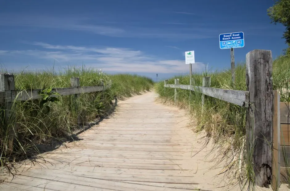
Photo by Ghost Acolyte on Pexels
If you are planning a trip to Florida's Scenic 30A, knowing where you can legally park your car, rinse off the sand, and walk onto the beach makes the difference between a relaxing day and a frustrating hunt. Walton County's beaches along Scenic Highway 30A offer 50 public beach accesses scattered along 26 miles of coastline. But not every access looks the same, and the best map for your day depends on whether you need parking, restrooms, or a spot close to your rental. I have pulled together the most reliable sources for a 30A public beach access map so you can spend less time searching and more time in the water.
How Many Public Beach Accesses Are There on 30A?
Walton County maintains 50 public beach accesses along the 26 miles of Scenic Highway 30A. These accesses range from small sandy paths with no parking to full-service lots with bathrooms, showers, and handicap-accessible walkovers. The exact number can feel overwhelming, but the county and tourism boards have created several tools to help you pick the right spot. Knowing that you have 50 choices means you can spread out and avoid the crowds if you are willing to walk a few extra steps.
Where to Find an Interactive 30A Public Beach Access Map
Several organizations and local groups have built interactive maps that show public and private beach access points along 30A. Each map has a slightly different focus, so I like to use a couple of them together to get the full picture.
Official Walton County Interactive Map
Walton County provides a Beach Access Selection Chart on its official website, mywaltonfl.gov. This chart lists specific accesses by name, such as Seabreeze #6 and Gulf Lakes #7, along with details like the number of parking spaces, availability of restrooms, and other amenities. The county also developed an interactive map using current property appraiser data that shows green and blue beaches open to the public. These are beaches owned by the state or county. This is the most authoritative source for knowing whether a stretch of sand is public or private.
Visit South Walton Tourism Map
The official tourism site for South Walton, visitsouthwalton.com, features an interactive map that shows the location of public and private beaches as well as their access points. This map is easy to use on a phone or tablet, and it is updated regularly to reflect any changes in access or parking. If you want a map that combines tourism information with beach access details, this is a good starting point.
SoWal.com Map of Beach, Bay, and Lake Accesses
The local community site sowal.com offers a map that includes beach, bay, and lake accesses. It allows you to filter by features such as accessible, bicycling, boat ramp, camping, and tent sites. This is particularly useful if you plan to launch a kayak or spend part of your day on the bay side of 30A. The map covers more than just the Gulf beaches, so it is a helpful resource for multi-activity trips.
30A Beach Girls Color-Coded Map
For a visual breakdown of different sections, 30a-beachgirls.com offers an interactive map that color-codes different sections of the beaches and shows regional and neighborhood beach accesses. This map is popular with visitors because it groups accesses by town or neighborhood, making it easier to choose a spot close to your rental or favorite restaurant.
Facebook Group Map
A local Facebook group has created a beach access map that claims to include every beach access point along 30A. While this map is user-generated and may not be officially verified or complete, it can be a handy supplement to the official sources. Just cross-check any specific amenity claims with the Walton County selection chart before you rely on it for parking or bathroom availability.

Photo by Hub JACQU on Pexels
What to Look for on a 30A Beach Access Map
When you pull up any 30A public beach access map, you will see markers or pins for each access point. But the details beneath those markers matter. Here are the key features to check before you head out.
- Parking: Many accesses have very limited parking or none at all. Look for lots with 10 to 50 spaces. Accesses listed in the county selection chart will specify the number of parking spots. If you see "no parking," plan to bike or walk.
- Restrooms: Not all public accesses have bathrooms. The chart and interactive maps usually indicate whether restrooms are available. Some have portable toilets, others have permanent facilities.
- Showers: Outdoor showers are common at larger accesses but are not guaranteed at every spot. Rinsing off before getting in the car is nice after a sandy afternoon.
- Handicap Accessibility: Walton County has several handicap-accessible walkovers and beach matting. Look for the wheelchair icon on the map if you need barrier-free access.
- Neighborhood or Regional: Some accesses serve a specific neighborhood and may have parking restrictions for non-residents. Regional accesses are generally open to all visitors with parking lots.

Photo by Stephen Leonardi on Pexels
Spotlight on Bramble Grove Road Beach Access
One access that checks many boxes is Bramble Grove Road, located at 3468 Scenic 30A East in Seagrove Beach. According to local sources, this access has bathrooms, handicap accessible walkovers, showers, and parking. It is a good example of what a well-equipped 30A public beach access looks like. If you are staying in or near Seagrove Beach, putting this access on your map can save you from circling the block for a spot.
Tips for Using the 30A Public Beach Access Map
Having a map is only half the battle. Here are a few practical tips to make the most of the 50 public beach accesses along 30A.
- Plan ahead for parking. The most popular accesses near Seaside, Grayton Beach, and Rosemary Beach fill up early during peak season and holidays. Arrive before 9 a.m. or plan to bike if you can. The interactive maps from Walton County and Visit South Walton let you see which lots still have space, but they are not real-time, so treat them as a guide, not a live feed.
- Cross-reference maps. I like to start with the official county map to confirm public status, then switch to the SoWal or 30A Beach Girls map for details on nearby amenities like bike paths or picnic tables. Using two maps takes two minutes and can prevent a wasted trip.
- Check for seasonal changes. Some access points close for nesting bird or sea turtle season. The county posts notices on its website, so check the mywaltonfl.gov page before you go, especially between May and October.
- Bring cash or a card. Parking fees may apply at some regional lots. The county selection chart notes paid parking areas. Have a backup plan if the lot is full.
- Walk a little farther. The accesses with smaller parking lots are often less crowded. If you are willing to walk 5 to 10 minutes from a nearby neighborhood access, you can have a stretch of sand almost to yourself.

Photo by Sean Thomas on Pexels
Frequently Asked Questions
How many public beach accesses are on 30A?
Walton County offers 50 public beach accesses along the 26 miles of Scenic Highway 30A. These range from simple sandy paths to full-service lots with restrooms, showers, and handicap-accessible walkovers. The exact number can vary slightly if temporary closures occur, but 50 is the standard count used by the county.
Which 30A beach access map is the most reliable?
The most authoritative map comes from Walton County government at mywaltonfl.gov, which uses current property appraiser data and shows green and blue beaches open to the public. The Visit South Walton map at visitsouthwalton.com is also reliable because it is maintained by the official tourism office. For a broader set of features, SoWal.com and 30a-beachgirls.com offer helpful supplements.
Do all 30A public beach accesses have parking?
No, not all 50 public accesses have parking. Many are small walkovers intended for local residents or pedestrians. The Walton County Beach Access Selection Chart lists each access with its available amenities, including the number of parking spots. Always check that chart before you drive to a specific access, especially during busy seasons.
Are there handicap-accessible beach accesses on 30A?
Yes, several accesses along 30A are handicap accessible. Bramble Grove Road in Seagrove Beach is one example that includes accessible walkovers. The county interactive map and selection chart indicate which accesses have handicap amenities. Beach wheelchairs may also be available at some regional accesses or through local rental companies.
Can I use a private neighborhood beach access if I am renting a house in that neighborhood?
If you are renting a property in a neighborhood with a private access, your rental agreement typically grants you access during your stay. However, public accesses are open to all, and the county map clearly marks which beaches are public. If you are unsure, stick to the county-designated public accesses to avoid any issues.
No matter which map you choose, having a reliable 30A public beach access map in hand will make your Emerald Coast vacation smoother. Bookmark the official Walton County page and the Visit South Walton interactive map before you leave home, and you will be ready to hit the sand without the stress.