
Guide
30A Beach Access Map: Find Every Entry Point Along Scenic Highway 30A
Use the 30A beach access map to find public entry points along Scenic Highway 30A. Learn about interactive tools, key access locations, and planning your beach day.
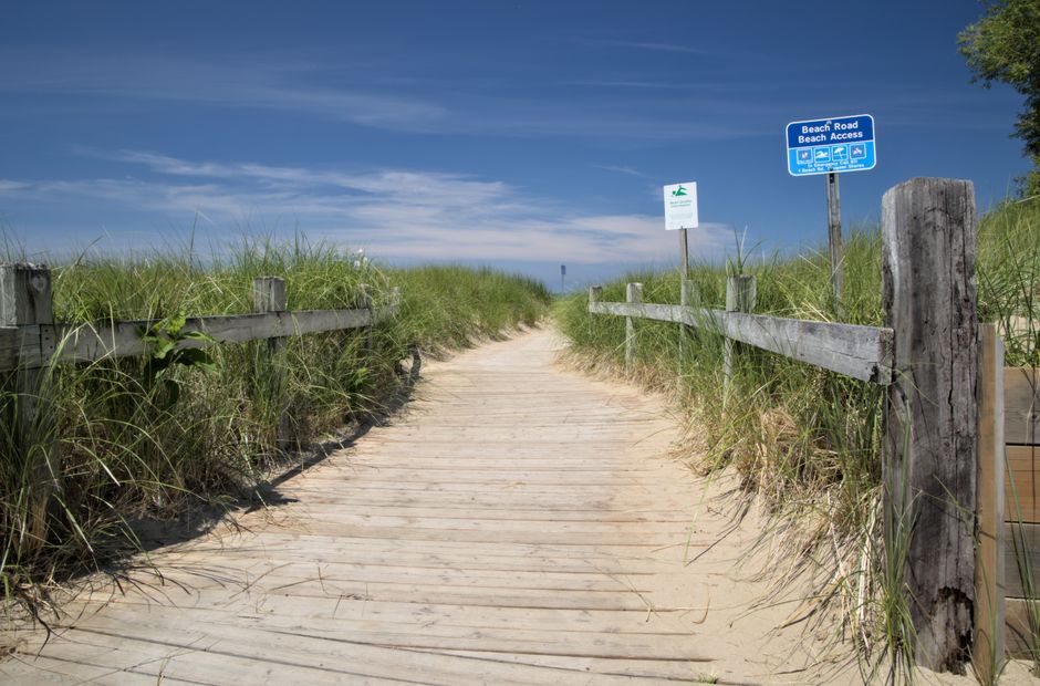
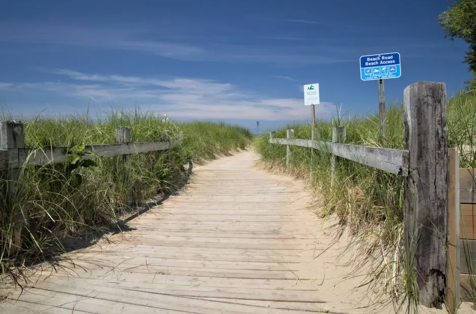
Photo by Ghost Acolyte on Pexels
Finding your way to the sand and surf along Scenic Highway 30A is easier when you know where the public entry points are. Whether you are staying in a rental cottage or just driving in for the day, a good 30A beach access map saves time and guesswork. The stretch of coastline between Dune Allen Beach and Inlet Beach is dotted with dozens of spots that lead directly to the Gulf of Mexico. Some are well-marked, while others blend into the landscape. I have put together this guide to help you understand the tools available for locating every beach access along 30A, from the official interactive map to handy reference charts.
The Interactive Beach Access Map
The most practical tool for planning your trip is the interactive beach access map hosted on visitsouthwalton.com. This map lets you type in your address or the name of your rental property to find the nearest public entry point. It uses current property appraiser data, so the information stays reasonably current. When you open the map, you will see beaches marked in green and blue. The green and blue colors indicate public access points, making them easy to spot at a glance. This interactive map is a great starting point whether you are a first-time visitor or a regular who wants to explore a new stretch of shore.
Because the map pulls from official county records, it covers the full 26 miles of Scenic Highway 30A. You can zoom in on specific neighborhoods like Seaside, Grayton Beach, or Blue Mountain Beach and see exactly where the walkovers and dune crossings are located. I recommend bookmarking the page on your phone before you head out, since cell service can be spotty in some areas near the beach.
How Many Public Beach Accesses Are There?
Scenic 30A runs for roughly 26 miles from west to east along Florida's Emerald Coast. According to local sources, there are about 50 public beach access points along that route. That number comes from a vacation rental site that tracks these details, so it is a helpful guideline rather than an official county count. The actual number may shift slightly as new walkovers are built or existing ones are renovated. The important thing to remember is that public access is plentiful. You rarely have to walk more than a quarter mile to find a dune walkover or a paved path to the sand.
The 26-mile corridor was originally part of State Road 30, which started at the Alabama state line and ran 283 miles east. That old highway gave the scenic road its name. Today, 30A is known for its beach towns, state parks, and preserved dune lakes. The beach access points are scattered along the entire length, connecting visitors to different types of shoreline, from wide sandy beaches to narrow strips backed by tall dunes.

Photo by Sean Thomas on Pexels
Key Beach Access Locations to Know
While the interactive map shows every public entry, a few specific access points are worth knowing by name. These locations are often mentioned in rental listings or local directions. The following spots appear on various 30A guides as notable entry points:
- Bramble Grove Road – A quiet access point that tends to be less crowded than the larger regional accesses.
- Gulfview Heights Access – Located in a residential area, this walkover gives you a direct route to the beach without passing through a commercial district.
- Walton Dunes Access – Situated near the Walton Dunes community, this access offers parking and a boardwalk over the dunes.
- Blue Mountain Beach Access – One of the more popular stops along the eastern part of 30A, named for the blue‑tinged sand hills that give the area its name.
- Grayton Dunes Access – Close to Grayton Beach State Park, this access leads to a stretch known for its natural, undeveloped feel.
- Wall Street – An access point in the heart of the Rosemary Beach area, handy if you are staying in that walkable town center.
These are just six of the many public entries. The interactive map will help you find the one closest to where you are staying. If you are renting a house, ask the property manager which access they recommend. Many rental companies have their own local knowledge about the nearest walkover and whether it has stairs, a ramp, or a dune crossover.
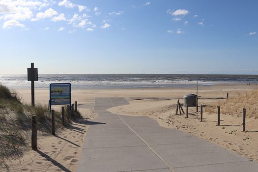
Photo by Jef KoeleWijn on Pexels
Using the Walton County Beach Access Selection Chart
In addition to the interactive map, Walton County provides a Beach Access Selection Chart. This is a PDF document available through mywaltonfl.gov. The chart lists each access point along with details such as the type of access (walkover, paved path, or dune walk), parking availability, and any nearby facilities. It is a static document, meaning it is not updated in real time, but it serves as an excellent planning resource when you are deciding which beach entry to use.
The selection chart is organized by town or area, so you can quickly find accesses near Seaside, WaterColor, Alys Beach, or Rosemary Beach. I like to print it out or save it to my phone before a trip. It pairs well with the interactive map – the map shows you the location, while the chart gives you the details. Together they give you a solid picture of what to expect before you head out.
Planning Your Beach Day with the 30A Beach Access Map
Getting the most out of the 30A beach access map means knowing a few practical tips. First, remember that not every pinpoint on the map is guaranteed to have parking. Some accesses are designed only for pedestrians coming from nearby neighborhoods. If you are driving in, look for accesses that have dedicated parking lots or spaces along the road. The interactive map and the selection chart both indicate parking availability, so check those before you go.
Second, be aware that some mapped accesses may be private or have restricted use. The map uses property appraiser data to show all legal entry points, but not all of them are open to the general public without limitations. Always look for the green and blue markers, which the site uses to indicate public access. If you see a marker in another color or a point that seems unclear, stick with the clearly labeled public entries.
Third, plan your timing. During peak summer months and holidays, the most popular beach accesses fill up early. If you arrive after mid‑morning, you might need to circle a bit or choose a less central access. The interactive map helps you find alternatives quickly. Zoom out and look for green or blue markers a block or two away from the main drag – those are often your best bet for a spot with less foot traffic.
Finally, respect the dunes and the beach ecosystem. The dune walkovers and boardwalks exist to protect the fragile vegetation. Always use designated paths and never climb over the dunes. The county puts a lot of work into maintaining these access points, and keeping them in good shape benefits everyone.

Photo by Stephen Andrews on Pexels
Frequently Asked Questions
How do I find the nearest 30A beach access?
Use the interactive beach access map on visitsouthwalton.com. You can type your address or rental property name into the search box, and the map will show the closest public entry points marked in green and blue. The map uses current property appraiser data, so it reflects the most up‑to‑date information available.
Are all the beach accesses on the map public?
Not every point shown on the map is a public access. The interactive map uses property appraiser data to display all legal entry points, but some may be private or restricted. The counties mark public accesses with green and blue colors. Stick to those markers to find places where you can legally enter the beach.
What does the interactive map color code mean?
On the interactive 30A beach access map, green and blue beaches indicate public access points. These are the spots that are open for anyone to use. Other colors or unmarked points may represent private property or restricted areas. The map is designed so you can quickly see which accesses are public based on the color.
How often is the beach access map updated?
The official interactive map draws from current property appraiser data, so it is updated when the county records change. That typically happens on a regular schedule as new developments are built or access points are added or removed. The static PDF Beach Access Selection Chart on mywaltonfl.gov is updated less frequently, so always rely on the interactive map for the most current information.
Getting to the beach along 30A is straightforward once you know where to look. The interactive map, paired with the selection chart, gives you everything you need to find your perfect spot. Bookmark the map before your trip, pick a few backup accesses, and enjoy the sugar‑white sand and emerald water that make this stretch of coastline so special.